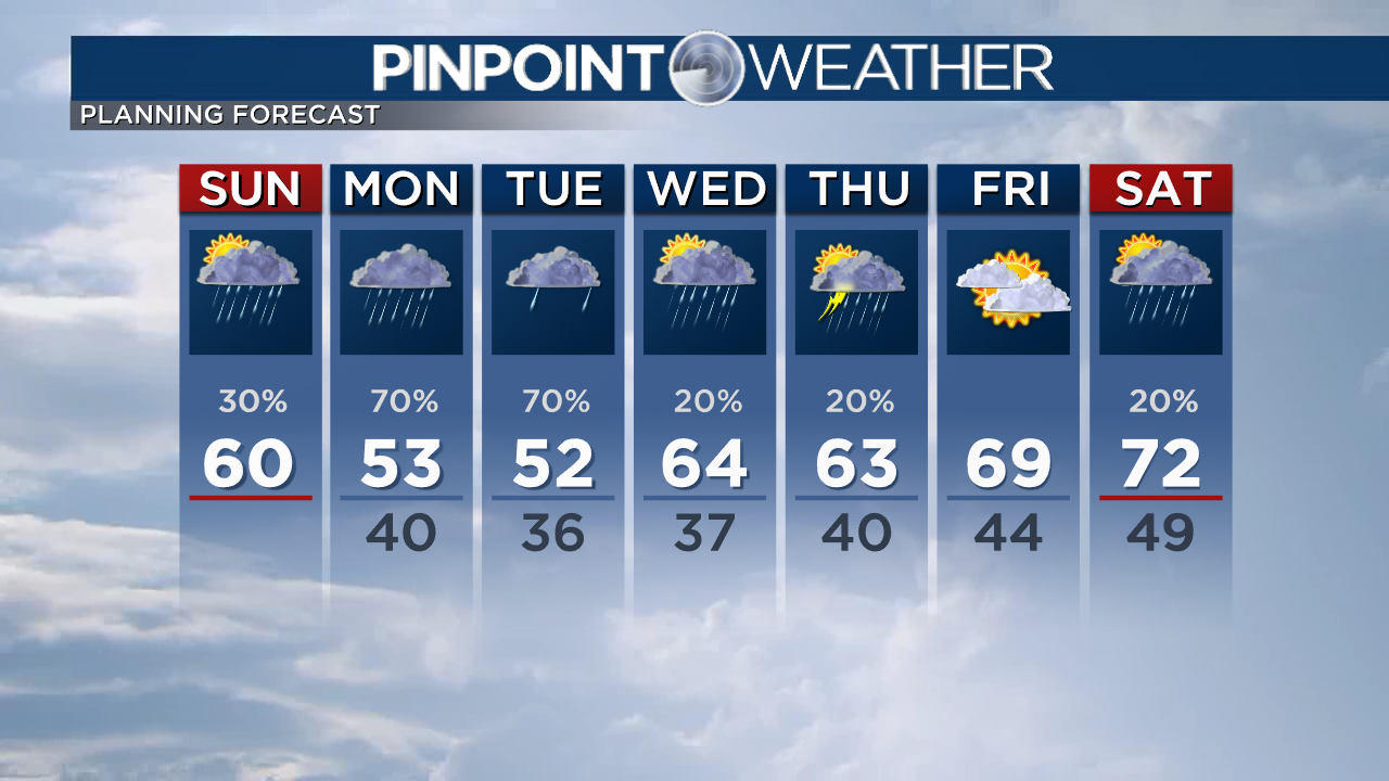
Our forecast on Sunday will be very similar to Saturday, with scattered showers and temperatures . Expect mountain snow showers through the day, with a couple of fresh inches possible in the high country. Across the Front Range, showers will be possible through the afternoon but the severe weather risk remains low. Will be capable of producing frequent lightning, heavy rain and strong winds. A couple of showers will linger overnight and through the Monday morning commute.
A powerful low pressure system will move through the country on Monday, bringing in additional cloud cover and rain. As a result, temperatures will continue to fall into the 50s. Showers will remain along the Front Range through the afternoon, with mountain snow showers continuing. We ll have to watch Monday night into Tuesday morning as temperatures will fall near the mark at the Denver metro region. As of now, a few flurries will be possible in parts of southern Larimer, Boulder, Jefferson and Douglas Counties, but accumulation is expected for the Tuesday morning drive.
We’ll start to warm up with highs jumping into the 60s, by the second half of this week. Expect a low threat of showers and thunderstorms through Friday.
Check interactive radar and zoom into where you are. Plus, check the radar anytime with the Pinpoint Weather App for iPhone and Android.

Pinpoint Weather Meteorologists Matt Makens, Christine Rapp, Chris Tomer, Chief Meteorologist Dave Fraser, Greg Dutra, and Jessica Lebel.
Pinpoint Weather has been independently licensed as Colorado’s Most Accurate Forecast by WeatheRate.
We’re tracking weather today on FOX31 Denver and Channel 2 News – and if conditions are bad we send out the Weather Beast.
Buy Tickets for every event – Sports, Concerts, Festivals and more buy tickets


