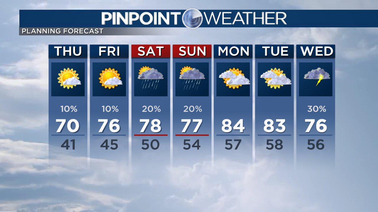
DENVER — A more ordinary spring-summer weather pattern is beginning to put in with dry mornings and isolated afternoon thunderstorms.
Thursday will have warmer highs around 70 degrees across the Front Range.
The mountains start dry, then await isolated day rain, snow and thunderstorms. Highs will be in the 40s, 50s and 60s.
The snowmelt at higher elevations kicks into high gear starting Thursday through the week. Expect rivers and streams to rise into next week.
Mountain highs hot into the 50s, 60s and 70s this weekend and into next week. Overnight lows do hit freezing, so it is mostly a day melt.
Saturday and Sunday start dry throughout the Front Range with isolated afternoon thunderstorms. Highs will reach 75 to 80 degrees.
Next week looks like drops 75 to 85 degrees most days and isolated afternoon thunderstorms.

Mountain Snowmelt: Freezing Level on the Increase. Meteorologist Chris Tomer.
Check interactive radar and zoom in to where you’re. Plus, check the radar everywhere using the Pinpoint Weather App for iPhone and Android.

Pinpoint Weather Meteorologists Matt Makens, Christine Rapp, Chris Tomer, Chief Meteorologist Dave Fraser, Greg Dutra, and Jessica Lebel.
Pinpoint Weather has been independently licensed as Colorado’s Most Accurate Forecast by WeatheRate.
We’re tracking weather today on FOX31 Denver and Channel 2 News – and if conditions are poor we ship from an Weather Beast.
Buy Tickets for every event – Sports, Concerts, Festivals and more buy tickets


